Plotting Sentinel 5P Data Part 2
Sven Haardiek, 2021-01-09
Some time ago, while I was working on the Emissions API Project, I wrote an article about Plotting Sentinel 5P Data. The main steps of the article were
- Downloading the data from the ESA in NetCDF format.
- Loading the data into a geopandas.GeoDataFrame.
- Reducing the data using Uber’s Hexagonal Hierarchical Spatial Index H3.
- Plotting the data using Matplotlib.
This had some disadvantages. We had to download a lot of data from the ESA, since we had to download a lot of additional informations and also reducing the data took quite a long time.
But since then the Emissions API Project has grown and so for completion I want to share with you a simpler method to plot beautiful images of world maps using the API from Emissions API and a small tool called Emissions API World Map Creator.
Installing the Emissions API World Map Creator is pretty easy, since there is a PyPi package.
# Creating a virtual environment
$ python -m venv venv
# Activate the virtual environment
$ . ./venv/bin/activate
# Install Emissions API World Map Creator
(venv) $ pip install emissionsapi-worldmap-creator
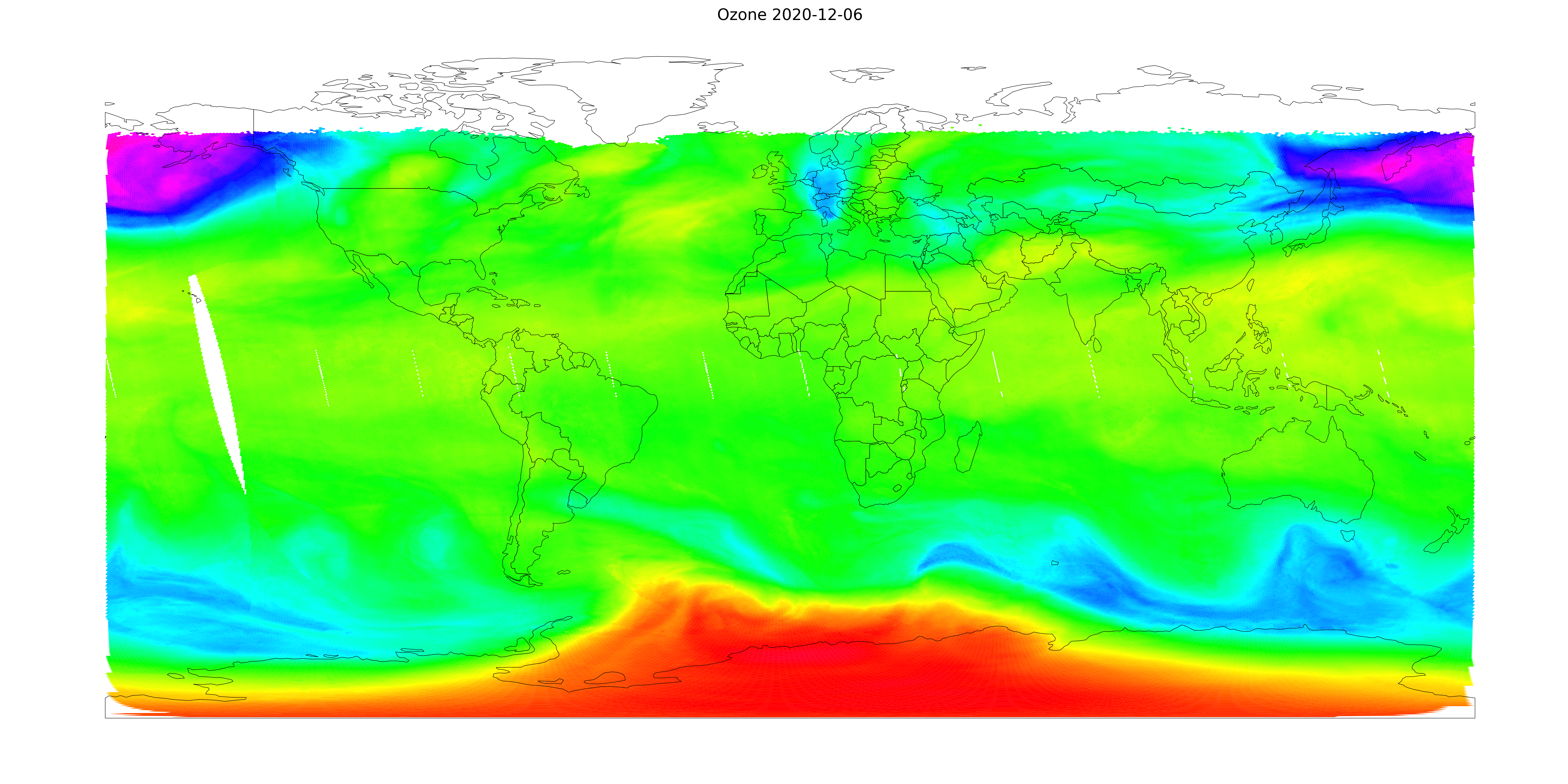
So now creating an world map is as easy as
(venv) $ emissionsapi-worldmap-creator ozone 2020-12-06
2021-01-02 11:38:16,790 - emissionsapi_worldmap_creator - Getting data.
2021-01-02 11:38:16,790 - emissionsapi_worldmap_creator - Downloading data from Emissions API
2021-01-02 11:38:46,488 - emissionsapi_worldmap_creator - Preparing the data
2021-01-02 11:39:31,756 - emissionsapi_worldmap_creator - Starting to plot
2021-01-02 11:39:32,060 - emissionsapi_worldmap_creator - Plotting hexagonal polygons
2021-01-02 11:40:10,750 - emissionsapi_worldmap_creator - Loading world map
2021-01-02 11:40:10,774 - emissionsapi_worldmap_creator - Plotting country borders
2021-01-02 11:40:10,795 - emissionsapi_worldmap_creator - Saving output to ozone-2020-12-06.png
In the background Emissions API World Map Creator is querying the API from Emissions API for the data, downloads them and plots the them as hexagons on a world map.
The result should look like this:
That is pretty easy, right?
The tool has a lot of more options to configure the image.
You can type emissionsapi-worldmap-creator --help to see which.
Most of them are pretty similar to the Matplotlib parameters.
Also the Emissions API World Map Creator is caching the data in cache-<product>-<data>.
So calling the image creation with other parameters will not download the data again and the process should speed up a bit.
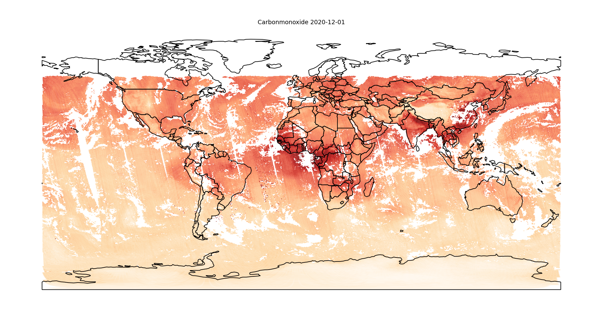
So as a teaser at the end I will show you a little bit more complex call
(venv) $ emissionsapi-worldmap-creator --colormap OrRd --vmin 0.01 --vmax 0.05 --pixels_x 1920 --pixels_y 1080 --font-size 40 carbonmonoxide 2020-12-01
--vmin,--vmaxand--colormapchanges the colormap, see Matplotlib: Colormap and Matplotlib: Colormap Normalization for more details.--pixels_xand--pixels_ycreate a image of the size 1920x1080.--font-sizereduces the font size of the title.
This should look like: